


TL;DR
- This blog is for engineering students, freshers, and technology learners exploring how drone infrastructure inspection is reshaping civil engineering, electrical systems, and transportation networks in India and globally.
- Traditional infrastructure inspection is dangerous, slow, and expensive, requiring scaffolding, lane closures, and workers in high risk environments that drones now eliminate.
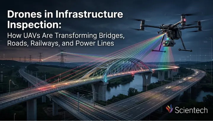
- Modern drones equipped with high resolution cameras, thermal sensors, and LiDAR technology can inspect bridges, roads, railways, and power lines faster, safer, and at a fraction of conventional cost.
- India’s regulatory framework under DGCA, combined with government schemes like PLI and Digital Sky, is actively building an ecosystem where drone based inspection is becoming standard practice.
- Students in civil, electrical, and aerospace engineering have strong career opportunities in drone infrastructure inspection with salaries ranging from 6 to 40+ LPA depending on specialization and experience.
India has hundreds of thousands of bridges across its national, state, and local road networks of kilometres of national and state highways, a railway network that is one of largest in the world, and a power grid serving over a billion people. Keeping all of that infrastructure safe is not a small task. It requires constant monitoring, early detection of damage, and fast repair decisions.
Traditionally, infrastructure inspection involves sending crews to climb bridges, walk railway tracks, drive along highways, and scale high-voltage towers. It is slow, expensive, and genuinely dangerous. Workers have been injured doing this kind of work. And because it takes so much time and money, many inspections get delayed sometimes by years.
That is changing. Drone infrastructure inspection has emerged as one of the most practical and impactful applications of UAV technology. A drone equipped with right sensors can cover in hours what would take a human crew days. It can access angles no person can safely reach. And it captures richer, more accurate data than a manual walk through ever could.
This blog breaks down how drones are being used across four critical infrastructure domains bridges, roads, railways, and power lines and what this means for engineering students building careers in India’s growing drone ecosystem.
Also Read,
- How LiDAR and Thermal Imaging Are Expanding Drone Applications
- Drone Swarm Applications in Defense, Agriculture & Industrial Automation
- BVLOS Drone Operations: How Beyond Visual Range Works
Why Traditional Infrastructure Inspection Has a Problem
Before exploring how drones help, it helps to understand why the old approach is struggling.
Think about inspecting the underside of a highway bridge. Inspectors need to either set up scaffolding from below or dangle from harnesses attached to a vehicle parked on top. Both approaches require lane closures, safety equipment, large crews, and hours of setup before a single photo is taken. According to industry data, Manual bridge inspections can cost several thousand dollars depending on the bridge size, access requirements, and traffic management involved once you factor in equipment rentals, safety personnel, and traffic management. That number scales up significantly for larger structures.
Power line inspection carries similar challenges. Technicians have historically needed to climb steel towers near live conductors or fly alongside lines in manned helicopters both of which carry serious risk. Railway track inspection requires sending crews walking for kilometres at a time, often in hazardous conditions, to spot damage that the human eye may miss entirely.
Studies have shown that drone-based inspections can reduce inspection time by up to 88% compared to traditional methods, depending on project type and inspection requirements by eliminating expensive equipment and minimising need for large inspection crews. Those are not marginal improvements. They represent a fundamental shift in how infrastructure maintenance works.
The core insight is simple: if a drone can do a job more safely, more quickly, and with better data, the only question is how to deploy it effectively.
What Makes a Drone Suitable for Infrastructure Inspection
Not every drone you see in a hobbyist video is built for infrastructure work. Professional inspection drones are purpose built machines with specific hardware configurations that determine what they can detect and report.
Core Hardware Components
Every inspection drone rests on a platform typically a multirotor or fixed wing design and carries a combination of sensors called payloads.
High Resolution RGB Cameras are a starting point. These are essentially very precise cameras that capture detailed visual images. When mounted on a stabilised gimbal (a gyroscopic mount that compensates for wind and movement), they can photograph concrete surfaces, steel joints, and rail tracks with enough clarity to identify cracks just a few millimetres wide.
Thermal Infrared Cameras go further. They detect heat radiation rather than visible light. Thermal cameras detect heat signatures that indicate electrical problems, loose connections, or component failures. Overheating equipment often shows temperature anomalies well before visible damage occurs, making thermal inspection a powerful predictive maintenance tool. For power lines, this is especially valuable: a faulty connection heats up before it fails, and a thermal drone can spot that problem weeks before a blackout occurs.
The most advanced layer is the LiDAR Sensors. LiDAR uses laser pulses to measure distances and generate highly accurate 3D models of structures and surrounding terrain. The LiDAR sensors are used to send out pulses of laser light and to measure the time it takes for each pulse to reflect back from the object. This information is then added to build up a detailed 3D model of power lines and their immediate surroundings. For bridges, it involves creating a 3D digital model of each surface that is as accurate as possible, and allow engineers to analyse it in detail without having to go to the site itself.
Multirotor vs Fixed Wing Drones
Multirotor UAS’s are extremely agile and can hover. They’re ideal for examining buildings, bridges, telecommunication equipment and other structures where precise images and videos are required. Fixed wing drones are similar to a traditional aircraft with fixed wings, used for long distance flights. They can be deployed to large infrastructure systems like pipelines or power lines and cover a large area in a short time.
As far as practice is concerned, a multirotor will be your precision tool for a single bridge or substation. If you want to survey 50 kilometres of railway track in one flight, you need a fixed wing drone.
Learning Takeaway: For aspiring drone professionals, choosing the right sensor payload is often more important than the drone platform itself. Understanding how to collect and interpret sensor data is becoming just as valuable as learning to fly the aircraft. Modern drone inspectors are valued not only for their flying skills but also for their ability to select the right sensors and accurately interpret the data collected during inspections.
Drone Infrastructure Inspection: Bridge Applications
Bridges are among the most complex and costly structures to inspect using conventional methods. They require lane closures, specialised equipment, and significant safety oversight. UAVs streamline this process while providing richer data.
What Drones Actually Inspect on a Bridge
When a drone approaches a bridge for inspection, it systematically photographs and scans multiple structural zones:
deck surface is top surface vehicles drive on. Drones capture high resolution images to identify surface cracking, pothole formation, water pooling patterns, and expansion joint damage.
superstructure refers to load bearing elements above deck girders, trusses, arches, or cable systems in suspension bridges. Drones can fly alongside these elements at close range, capturing imagery from angles inspectors cannot safely reach.
substructure includes piers and abutments parts that connect bridge to ground or water below. Inspecting underwater or near water components has traditionally been extremely difficult. Drones can efficiently inspect above-water bridge substructures. Drones can efficiently inspect above-water portions of bridge substructures. Underwater components typically require specialised remotely operated vehicles (ROVs) or professional divers of bridge substructures, while underwater components typically require specialised underwater drones (ROVs) or divers.
Drones easily navigate bridge decks and superstructures, scanning for cracks, material degradation and corrosion. In some specialised inspection workflows, drone imagery may be combined with non-destructive testing (NDT) methods to investigate suspected subsurface defects, ensuring comprehensive assessments.
Real World Application: New York Bridge Case
A bridge inspection project in New York City demonstrated how drones can safely capture detailed structural data without disrupting live traffic. The images consisted of more than 1,000 twenty-megapixel, geotagged, high resolution photographs and 3 hours of 4K high definition footage were taken in 6 hours of flying. A General Bridge Quality Assurance Inspection Report was completed identifying the repairs or structural deficiencies, etc. that were of interest. Most importantly: drones operated safely away from live traffic throughout.
This is particularly valuable in India, where the roads are often clogged and closures are a major inconvenience for the community. Similar benefits can be realised on major Indian bridges such as Bandra Worli Sea Link, Howrah Bridge, or many of the numerous flyovers in Delhi and Mumbai.
Drones in Road and Highway Inspection
India’s national highway network spans over 1.4 lakh kilometres, and maintaining it requires constant monitoring of surface conditions, drainage systems, crash barriers, and embankment stability. Sending inspection teams along every stretch manually is neither practical nor cost effective.
Drones have changed this equation significantly.
Roadway inspections can be done quickly by drones without closing lanes. A drone flying at a consistent altitude above a highway can generate orthophotos (geometrically corrected aerial images) and surface condition maps with centimetre level accuracy. Road engineers can use these maps to identify cracking patterns, assess pavement distress, and prioritise repair budgets all without deploying ground crews.
What Highway Drone Inspection Covers
There are multiple kinds of deliverables that are generated by a highway inspection drone mission:
Surface condition assessment detects potholes, longitudinal cracks, transverse cracks and separation at the top asphalt layer (delamination). The results are directly incorporated into pavement management systems that can determine when and where repairs are needed.
Drainage assessment involves analysing water pooling within an area using LiDAR or photogrammetry data to see if there are any water pooling areas that might increase pavement deterioration or flooding.
Infrastructure component inspection includes the inspection of crash barriers, road signs, soil embankments, culverts and retaining walls in highway corridors.
The use of drone technology made field time and cost savings of half the traditional survey methods. It also increased safety on site by allowing crews to get off of hazardous shoulders on the roadway.
If you are taking civil engineering classes, it has direct implications with highway engineering classes, where you use tools for pavement analysis and traffic engineering, which are increasingly fed by datasets derived from drones.
Railway Track and Infrastructure Inspection by Drone
Railways present a unique inspection challenge. Tracks can stretch for thousands of kilometres through varied terrain: flat plains, mountain passes, dense forests, and bridges over rivers. Inspecting all of it manually is slow, labour intensive, and often dangerous for teams walking tracks.
Drones scan miles of railway in a single operation, detecting broken rails, head checking, corrugations, indentations, and flaking. Drones can also monitor tracks for obstacles like fallen trees, abandoned vehicles, and power line collapses.
Scope of Railway Drone Inspection
The UAV mission for a railway corridor is very detailed, and a drone can complete a multi-faceted assessment in one mission.
The track geometry analysis is a photogrammetry and LiDAR based tool to verify the verified track alignment, gauge width, and elevation irregularities that could increase derailment risk, gauge widening, and elevation irregularities that could lead to derailment.
Overhead equipment inspection involves inspection of the condition of catenary wires (overhead power supply to electric trains), insulators and pantograph contact surface on electrified lines.
Thermal cameras are also mounted on drones to identify temperature variations in the tracks that could be signs of problems, such as incorrect welding or excessive friction between the wheels on the train. They can also perform inspections on the condition of the overhead lines, signals, and switches to ensure safe and efficient operations of the railway network.
Another key inspection point is whether vegetation is encroaching on the track corridor. Close growing trees and shrubs can derail or short out equipment. A multispectral sensor mounted on a drone can detect encroaching vegetation before it becomes a problem.
International Example with Relevance to India
Korean Railroad Research Institute uses AI powered drones to inspect railway infrastructure and reports 90% precision in inspection camera images and 100 mm accuracy for defect location.
India’s Railways, operating one of world’s largest railway networks with over 67,000 kilometres of track, stands to benefit enormously from similar deployments. Indian Railways has been exploring UAV based inspection as part of its broader modernisation drive, and this represents a significant area of growth for engineering professionals in the coming decade.
Power Line and Electrical Grid Inspection Using Drones
Power line inspection could be one of the most significant improvements in the field of infrastructure inspection in which drones are outperforming the alternatives.
Power lines are located on difficult terrain. To inspect them requires either sending up technicians to walk along steel lattice towers near the energized conductors or deploying manned helicopters to fly near the energized conductors at a low altitude. Both methods risk life as well as livelihood. Both are expensive. Both cannot easily offer the type of systematic documentation, rich with data, needed for modern grid management.
High altitude power transmission structures are checked for visual damage and tower corrosion from a drone. Thermal cameras can detect abnormal heat patterns that may indicate faulty connections, overloaded components, or electrical faults.. Drones can also be used for right of way monitoring, such as vegetation and fauna hazards or illegal construction areas.
What Drones Detect on Power Lines
Visual inspection identifies physical damage to conductors, insulators, cross arms, and tower components. High zoom cameras can examine individual components in detail without the drone needing to approach dangerously close.
Thermal inspection is where drone power line inspection truly excels. High resolution RGB cameras capture sharp imagery of insulators, conductors, and fittings. Thermal sensors detect hotspots caused by loose connections or overloaded circuits. LiDAR data provides raw information to build precise 3D models of towers and surrounding vegetation, helping utilities identify clearance issues.
LiDAR corridor mapping is increasingly used for transmission line management. LiDAR technology creates precise three dimensional maps of powerline corridors. These detailed measurements help identify vegetation encroachment, structural changes, and clearance violations that might not be apparent in standard photography.
The practical result is that power utilities can now monitor thousands of kilometres of grid infrastructure proactively, catching failures before they become outages rather than responding after blackout has already occurred.
India’s Power Grid Context
India operates one of the world’s largest and most complex power grids, managed by entities including Power Grid Corporation of India (PGCIL) and various state distribution companies. With rural electrification goals still ongoing and existing infrastructure ageing, regular inspection is critical. Companies like Tata Power and Adani Electricity are already adopting drone based inspection practices, and this is expected to scale significantly as BVLOS regulations mature.
Technology Stack: From Flight to Actionable Report
Understanding drone infrastructure inspection means understanding that drone flight itself is only the first step. Real value comes from what happens after data is collected.
Data Processing and Software
Once a drone completes its mission, raw data, thousands of images, thermal frames, and LiDAR point clouds need to be processed into usable reports.
Photogrammetry software stitches individual images into orthomosaic maps and 3D models. Tools like Pix4D, DroneDeploy, and Bentley ContextCapture are widely used for this purpose.
AI powered defect detection is an emerging layer. Machine learning models trained on thousands of labelled infrastructure images can automatically flag cracks, corrosion, and anomalies in drone imagery, dramatically reducing time engineers spend on manual analysis. A model trained on bridge inspection images, for example, can scan thousands of photos in minutes and highlight sections requiring human review.
Data management platforms store inspection records in centralised repositories, enabling engineers to track changes over time, compare current conditions to previous baselines, and build predictive maintenance schedules.
Why this matters for engineering students: The skill of data interpretation and report generation is becoming just as important as the ability to fly. Students who combine drone operations with GIS skills, Python based data processing, or AI tools will have a significant competitive advantage.
Drone Infrastructure Inspection in India: Regulatory and Industry Landscape
India’s drone ecosystem has evolved substantially over the past several years, creating a structured environment for commercial inspection operations.
Regulatory Framework
With the enactment of the Drone Rules 2021, the regulatory framework for UAVs in India has undergone a significant transformation. The new system under DGCA focuses on a more liberal one and strong safety measures. Later amendments in 2022 and 2023 have further clarified the licensing and insurance criteria, recognizing the role of drones in logistics, agriculture and infrastructure inspection.
As of 2025 , India has registered 38,500+ drones (UIN), 39,890 remote pilots (DGCA Certified) and 244 training organisations.
For those who are interested in flying a drone in India for commercial purposes for assessing infrastructure, a few requirements must be met. DGCA’s Valid Remote Pilot Certificate (RPC) is required. Drones will be registered on the Digital Sky platform and given a Unique Identification Number (UIN). Precautionary clearance is needed for operations near controlled airspace or strategic areas.
With government policy reforms, PLI scheme for domestic manufacturing and growing commercialization in the field of Agriculture, Infrastructure, Logistics and Defence, the value of the Indian Drone Industry is expected to touch Rs 15,000 crore by 2030.
Key Indian Companies in Drone Infrastructure Inspection
Several domestic players have established themselves in this space:
Garuda Aerospace, based in Chennai, is one of India’s largest drone companies and operates inspection services across power, infrastructure, and agriculture domains.
Asteria Aerospace, with IISc origins and partnerships with Airbus, develops UAV platforms suited for infrastructure and defence inspection.
ideaForge Technology, listed on Indian stock exchanges, manufactures drones used for surveillance and infrastructure inspection by government agencies.
Skylark Drones offers AI powered drone analytics platforms with a strong focus on mining and infrastructure site management.
Skye Air and ANRA Technologies are among emerging players focused on BVLOS operations, which will be critical for long corridor railway and power line inspections.
Large infrastructure and energy companies including Larsen and Toubro, Tata Projects, and Power Grid Corporation are increasingly incorporating drone inspection into their project delivery workflows.
Future of Drone Infrastructure Inspection
This technology is on a clear trajectory, moving towards even more automation, autonomy, and integration with AI.
Autonomous inspection missions are already being deployed in several industries, where drones follow pre-programmed flight paths, collect inspection data, and return automatically to charging stations without manual intervention, where a drone flies a pre programmed mission, collects all the data it needs and returns to base without being controlled by people while in flight. Companies like FlytBase are conducting drone pilots in a Box where drones reside in a weatherproof charging station and take off automatically when a need for an inspection arises, with energy and utility clients being among those testing the use of Drone in a Box.
AI defect detection is maturing very quickly. With large labelled datasets, models can now accurately detect specific cracks, broken or damaged insulators and vegetation encroachment in drone images, thereby cutting the delay between image capture and maintenance actions.
The next step in the future is integration with digital twins. The 3D models continuously updated from drone inspections can help engineers simulate the impact of various maintenance options in advance, without investing any rupees in physical repairs.
All of these developments are opportunities for engineering students entering the profession today, and are opportunities that will shape the future for professionals in this space in 10 years.
Conclusion
Drone infrastructure inspection is no longer a future concept. It is already transforming how governments and industries inspect and maintain critical infrastructure across India and around the world. Drone-based inspections are changing how nations manage and protect their most valuable physical assets. UAVs with precision sensors are providing inspection capabilities that were not available 10 years ago, from identifying a hairline crack in a bridge girder before it becomes a complete structural failure, to spotting a hotspot on a high voltage insulator before it causes a power outage.
The drone infrastructure inspection is not only cost saving, but also safety enhancing and data rich. It is an actual change for the way civil infrastructure is monitored and maintained. For a nation of India with the infrastructure needs and growth aspirations, this technology cannot be avoided, but is required at scale.
UAVs are a technology revolution that will impact the built environment in one of the most meaningful ways, and engineering students who develop the skills to operate the aircraft, process the data they collect, assess the structures they photograph and analyze the data with artificial intelligence will be at the heart of it. A regulatory framework is in place. The industry is growing. Career pathways are well defined. For students and professionals willing to build technical expertise in drone operations, data analysis, and infrastructure engineering, this field offers significant long-term opportunities.
Frequently Asked Questions
Drone infrastructure inspection uses unmanned aerial vehicles equipped with high resolution cameras, thermal sensors, and LiDAR technology to assess conditions of bridges, roads, railways, and power lines from air. Unlike traditional inspection which requires scaffolding, lane closures, and workers in hazardous positions, drone inspection delivers richer data faster and without putting personnel at risk.
Two main drone platforms are used in drone infrastructure inspection. Multirotor drones, such as quadcopters and hexacopters, are highly manoeuvrable and suitable for detailed inspections of bridges, towers, and substation components where hovering and close range photography are needed. Fixed wing drones are designed for long distance coverage and work better for linear infrastructure like highways, railways, and power line corridors. Both carry interchangeable payloads including RGB cameras, thermal sensors, and LiDAR units depending on inspection requirements.
Drones inspect power lines using a combination of high resolution visual cameras to detect physical damage on conductors, insulators, and tower components, and thermal cameras to identify hotspots caused by loose connections or faulty components. LiDAR sensors generate precise 3D corridor maps that help utilities identify vegetation encroachment and structural clearance violations. This approach removes the need for technicians to climb energised towers or fly manned helicopters close to live wires, significantly improving safety and operational efficiency.
All commercial drone operations in India, including infrastructure inspection, require compliance with DGCA’s Drone Rules 2021 and subsequent amendments. Operators must obtain a Remote Pilot Certificate, register their drone on Digital Sky platform to receive a Unique Identification Number (UIN), and comply with airspace zone restrictions. Flights near controlled airspace or strategic zones require prior approval. As of 2025, BVLOS operations for long corridor inspections require specific waivers, though India’s regulatory framework is progressively moving toward more streamlined BVLOS authorisation.
Engineering students can pursue several career paths in this field. Civil engineering graduates commonly work as drone survey analysts or structural inspection specialists, interpreting aerial data for bridge and highway projects. Electrical engineering students move into power line inspection roles with utility companies. Electronics and communication engineers contribute to drone hardware development and sensor integration. Computer science graduates are in demand for AI based defect detection systems and inspection data platforms. Indian companies actively hiring include Garuda Aerospace, Asteria Aerospace, ideaForge, Skylark Drones, Larsen and Toubro, and Tata Projects.

